Serra do Risco trail that passes along the Serra do Risco crest that crosses one of the extraordinary places of the Arrábida Natural Park, Marmitas do Gigante, Portugal
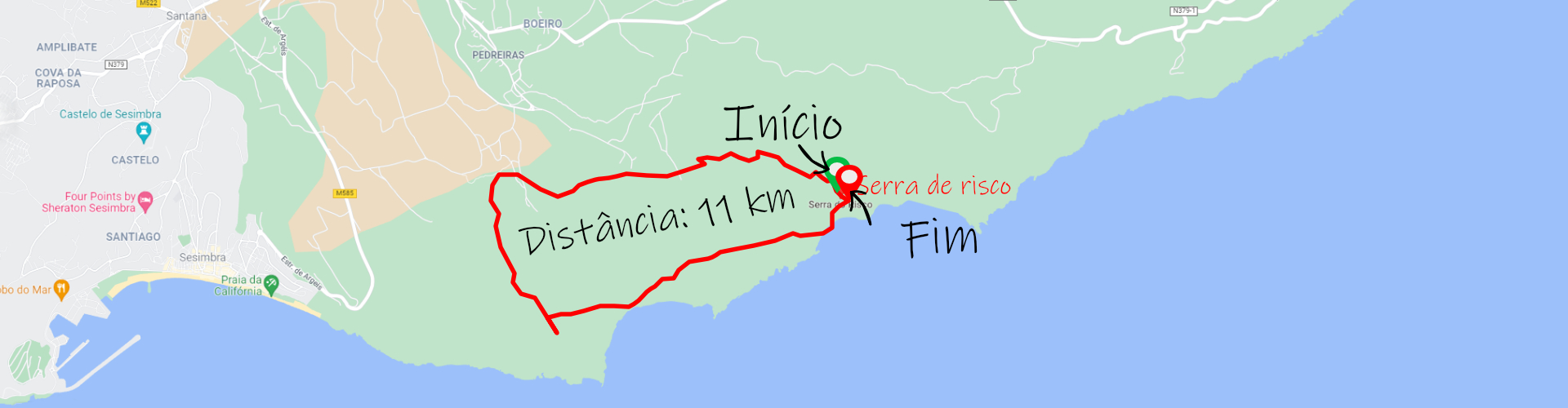
Serra do Risco Trail (Arrábida);
Distance: 11 km;
Circular: yes;
Technical Difficulty: Difficult;
Departure/Arrival Location: Serra de Risco.
Distance: 11 km;
Circular: yes;
Technical Difficulty: Difficult;
Departure/Arrival Location: Serra de Risco.
The Arrábida Natural Park is a biogenetic reserve located on the Setúbal peninsula, covering the municipalities of Palmela, Setúbal and Sesimbra, with the highest altitude at Pico do Formosinho, 501 meters high, in the district of Setúbal, in Portugal.
The Park extends for 35 kilometers including several mountains such as Serra do Louro, Serra do Risco, Serra de São Luís, Serra dos Gaiteiros, Serra Longa, Serra de São Francisco and Serra da Arrábida itself.
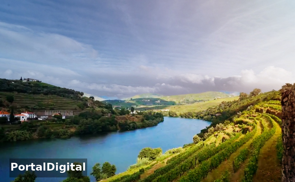
The combination of blue waters with the green vegetation of the mountains provides the perfect color for an escape into nature where there are countless trails and walking routes that can be followed in this natural sanctuary and the difficult part is choosing.
Portinho da Arrábida Beach, located in the Serra da Arrábida Natural Park, has fine white sand and the varied shades of blue of the clear waters contrast with the vegetation of the mountains, forming a beautiful setting that invites you to rest.
In this peaceful bay it is possible to go diving to observe marine diversity, although spearfishing is prohibited as the seabed is also considered a natural reserve.
One of the best trails and walking routes is the Serra do Risco Trail, which passes along the Serra do Risco crest that crosses one of the extraordinary places in the Arrábida Natural Park: the Marmitas do Gigante.
Serra do Risco and Marmitas de Gigante are located in the Arrábida Natural Park in a place also known as Terras do Risco within Herdade da Casa do Calhariz.
The Serra do Risco cliff is the highest point on the Portuguese mainland coast, 380 meters at Píncaro, almost sheer to the sea, being the highest limestone coastal escarpment in Europe.
The views of the sea from Píncaro da Serra do Risco at around 382 meters high are simply brutal and rank among the best in Arrábida (top of the highest cliff in continental Europe).
Walk along the trail towards the sea and as you climb, you will see breathtaking scenery.
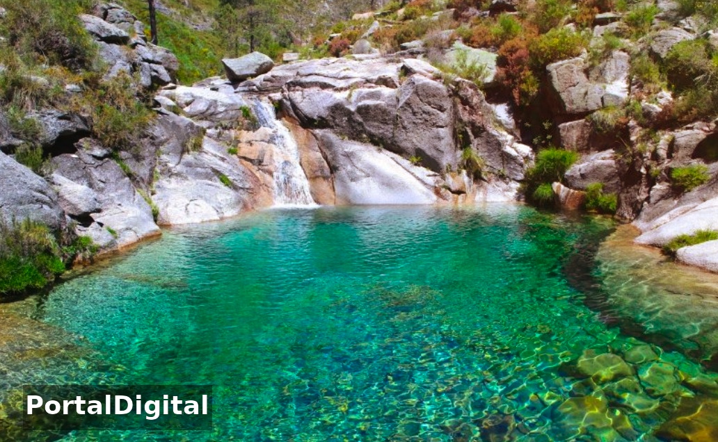
The Giant Lunchboxes are erosive phenomena on the rocks and whenever the water runs abundantly and strongly downhill, it carries various sediments. The water, in an attempt to find its best course, often hits hard, generating a whirlwind.
The sediments hit the rocks, eventually forming grooves and cavities that, over thousands of years, can reach great depths and form Marmites.
In the middle of the vegetation a huge clearing appeared with its waterfall-shaped marmites and the largest must be a good 6 meters deep and another 8 to 12 meters in diameter, which is simply magnificent.
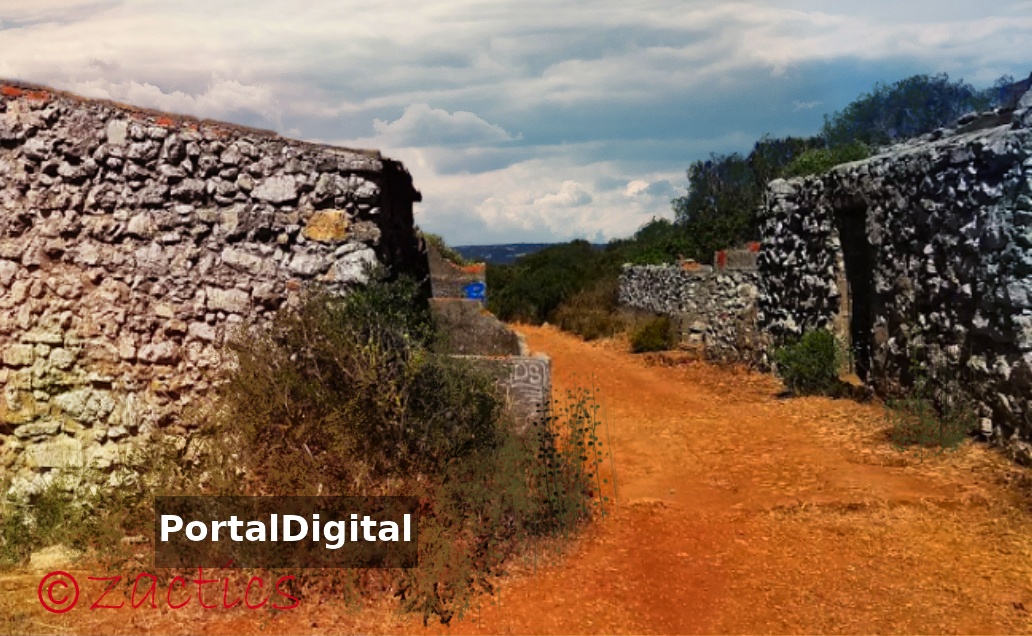
The Serra do Risco Trail is not well signposted and crosses areas with dense bush and we recommend that you take your GPS track with you and avoid wearing shorts and open shoes.
You should leave your vehicle parked in the small town of Casais da Arrábida and after traveling approximately 250 meters, turn left onto Estrada dos Casais do Calhariz (dirt road).
Walk for another 2900 meters and exit the road to your left. On this trail or main route (easy to identify) walk another 700 meters and at the end the Marmitas, despite being well hidden in a dense valley, are almost in front of you.
You will find the circular trail around the tallest trees and there you will find the Marmitas that are in front of you although hidden.
When you find Marmitas, return to the trail in the highest area, look at the crest of Serra do Risco and from here it will be easier to locate them.
As you climb the ridge of Serra do Risco you will realize that it is not an easy route, but don't be discouraged, because when you reach the top, you will quickly realize that all your effort was worth it.
The Park extends for 35 kilometers including several mountains such as Serra do Louro, Serra do Risco, Serra de São Luís, Serra dos Gaiteiros, Serra Longa, Serra de São Francisco and Serra da Arrábida itself.
The combination of blue waters with the green vegetation of the mountains provides the perfect color for an escape into nature where there are countless trails and walking routes that can be followed in this natural sanctuary and the difficult part is choosing.
Portinho da Arrábida Beach, located in the Serra da Arrábida Natural Park, has fine white sand and the varied shades of blue of the clear waters contrast with the vegetation of the mountains, forming a beautiful setting that invites you to rest.
In this peaceful bay it is possible to go diving to observe marine diversity, although spearfishing is prohibited as the seabed is also considered a natural reserve.
One of the best trails and walking routes is the Serra do Risco Trail, which passes along the Serra do Risco crest that crosses one of the extraordinary places in the Arrábida Natural Park: the Marmitas do Gigante.
Serra do Risco and Marmitas de Gigante are located in the Arrábida Natural Park in a place also known as Terras do Risco within Herdade da Casa do Calhariz.
The Serra do Risco cliff is the highest point on the Portuguese mainland coast, 380 meters at Píncaro, almost sheer to the sea, being the highest limestone coastal escarpment in Europe.
The views of the sea from Píncaro da Serra do Risco at around 382 meters high are simply brutal and rank among the best in Arrábida (top of the highest cliff in continental Europe).
Walk along the trail towards the sea and as you climb, you will see breathtaking scenery.
The Giant Lunchboxes are erosive phenomena on the rocks and whenever the water runs abundantly and strongly downhill, it carries various sediments. The water, in an attempt to find its best course, often hits hard, generating a whirlwind.
The sediments hit the rocks, eventually forming grooves and cavities that, over thousands of years, can reach great depths and form Marmites.
In the middle of the vegetation a huge clearing appeared with its waterfall-shaped marmites and the largest must be a good 6 meters deep and another 8 to 12 meters in diameter, which is simply magnificent.
The Serra do Risco Trail is not well signposted and crosses areas with dense bush and we recommend that you take your GPS track with you and avoid wearing shorts and open shoes.
You should leave your vehicle parked in the small town of Casais da Arrábida and after traveling approximately 250 meters, turn left onto Estrada dos Casais do Calhariz (dirt road).
Walk for another 2900 meters and exit the road to your left. On this trail or main route (easy to identify) walk another 700 meters and at the end the Marmitas, despite being well hidden in a dense valley, are almost in front of you.
You will find the circular trail around the tallest trees and there you will find the Marmitas that are in front of you although hidden.
When you find Marmitas, return to the trail in the highest area, look at the crest of Serra do Risco and from here it will be easier to locate them.
As you climb the ridge of Serra do Risco you will realize that it is not an easy route, but don't be discouraged, because when you reach the top, you will quickly realize that all your effort was worth it.