
The Loriga Gorge Route connects the upper plateau of Serra da Estrela and the village of Loriga
Loriga Gorge Route;
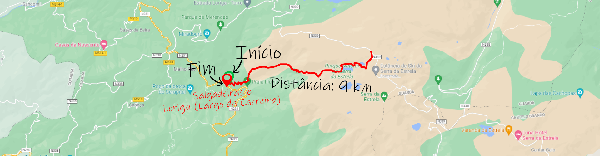
Distance: 9 km;
Circular: no;
Route Type: Linear;
Technical Difficulty: High;
Departure/Arrival Location: Salgadeiras and Loriga (Largo da Carreira).
Distance: 9 km;
Circular: no;
Route Type: Linear;
Technical Difficulty: High;
Departure/Arrival Location: Salgadeiras and Loriga (Largo da Carreira).
The most emblematic places on this trail include the Loriga Glacier Valley, Covões do Boleiro, Meio, Nave and Areia, the Covão de Meio dam and Eira da Pedra.
Although the trail is relatively short, it is very demanding and in winter it can be covered in snow and you should avoid this trail between November and April.
The route can start and end at Lagoas das Salgadeiras, one of the most visited in the region due to the proximity of the highway with easy pedestrian access and the landscape that surrounds it.
The route today passes through places where Serra da Estrela shepherds pass during their workdays and the landscape compensates for the demanding nature of the route despite taking it downwards.
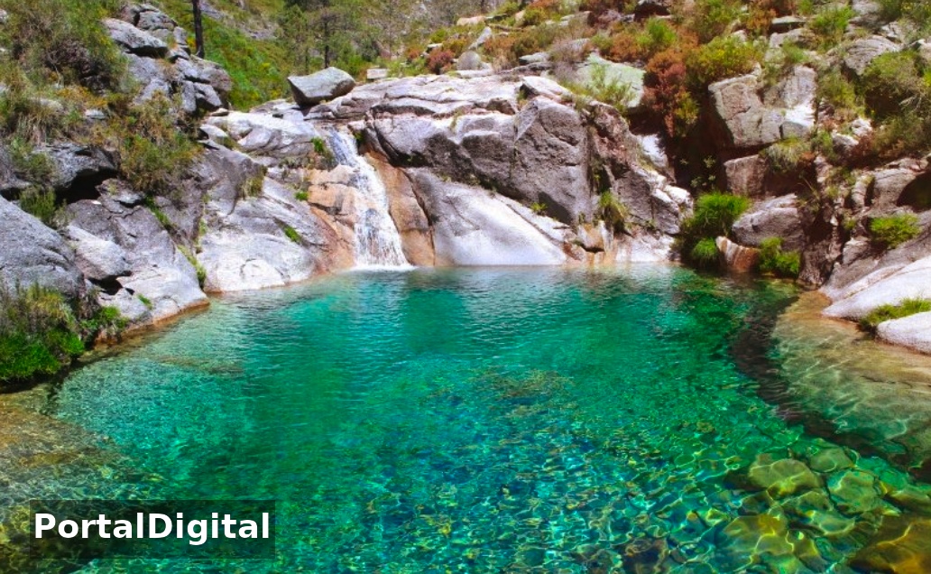
Along the route, there is a succession of four depressions called Covão Boieiro, Covão do Meio, Covão da Nave and Covão da Areia, which are home to a set of rare fauna and flora species exclusive to mountain environments.
The Mountain Paths are a network of short walking trails that, due to the scope and diversity of places covered, represent one of the most enriching ways of getting to know the region of the Serra da Estrela Natural Park.
The Loriga Gorge route passes through places still used today by shepherds to tend their flocks.
The Loriga Gorge route, taking as its starting point the highest point in mainland Portugal located at 1993 meters above sea level, we will descend the famous Loriga Gorge.
The trail, one of the most impressive in the mountains, is used by shepherds to guide their flocks of sheep and goats, and crosses the imposing glacial valley formed by lakes and pits.
The walk is demanding but the landscape makes up for the effort with moments of total absorption with nature.
The Loriga Gorge route connects the upper plateau of Serra da Estrela and the village of Loriga.
The route encompasses a landscape marked by glacial remains characteristic of the last cold period that hit this area.
Along the route, there is a succession of four depressions called Boieiro, Meio, Nave and Areia covões, which are home to a set of rare fauna and flora species exclusive to mountain environments.
The Loriga Gorge Route is a 16.1 kilometer low-traffic out-and-back trail located near Loriga, Centro Region, which features a lake and is classified as difficult.
The trail is primarily used for hiking and nature trips and is accessible year-round.
Although the trail is relatively short, it is very demanding and in winter it can be covered in snow and you should avoid this trail between November and April.
The route can start and end at Lagoas das Salgadeiras, one of the most visited in the region due to the proximity of the highway with easy pedestrian access and the landscape that surrounds it.
The route today passes through places where Serra da Estrela shepherds pass during their workdays and the landscape compensates for the demanding nature of the route despite taking it downwards.
Along the route, there is a succession of four depressions called Covão Boieiro, Covão do Meio, Covão da Nave and Covão da Areia, which are home to a set of rare fauna and flora species exclusive to mountain environments.
The Mountain Paths are a network of short walking trails that, due to the scope and diversity of places covered, represent one of the most enriching ways of getting to know the region of the Serra da Estrela Natural Park.
The Loriga Gorge route passes through places still used today by shepherds to tend their flocks.
The Loriga Gorge route, taking as its starting point the highest point in mainland Portugal located at 1993 meters above sea level, we will descend the famous Loriga Gorge.
The trail, one of the most impressive in the mountains, is used by shepherds to guide their flocks of sheep and goats, and crosses the imposing glacial valley formed by lakes and pits.
The walk is demanding but the landscape makes up for the effort with moments of total absorption with nature.
The Loriga Gorge route connects the upper plateau of Serra da Estrela and the village of Loriga.
The route encompasses a landscape marked by glacial remains characteristic of the last cold period that hit this area.
Along the route, there is a succession of four depressions called Boieiro, Meio, Nave and Areia covões, which are home to a set of rare fauna and flora species exclusive to mountain environments.
The Loriga Gorge Route is a 16.1 kilometer low-traffic out-and-back trail located near Loriga, Centro Region, which features a lake and is classified as difficult.
The trail is primarily used for hiking and nature trips and is accessible year-round.