It is located at the mouth of the Minho, in Alameda Luís Henrique Alves Pinto, parish of Ganfei, city of Valença, district of Viana do Castelo, North region and sub-region of Alto Minho
At the top there is a restaurant and an inn and next to the viewpoint there are several chapels, one of which is dedicated to Saint Peter of Rates, the medieval saint who protected rodent plagues.
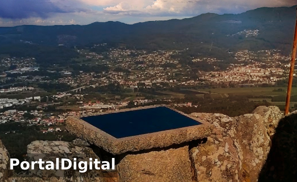
The Nossa Senhora do Faro Park is located at an altitude of 450 meters and has a large space made up of an immense forest of vegetation and centuries-old trees such as pine trees. It is considered one of the most privileged viewpoints in Alto Minho because it presents a magnificent and stunning view of the region and surroundings.
The elevation of Monte do Faro is clearly visible to the east of Valença, about six kilometers away, crowned by antennas and the view is fabulous, overlooking Valença, Tuy and a wide stretch of the River Minho.
At the top of Monte do Faro we find a chapel, a pillory and the visitor can observe a view that encompasses the entire Minho Valley (Portugal and Galicia) the busy commercial city of Valença with the bridge that connects Tui to the mouth of the river in Caminha.
A little further down are the chapels of Santa Ana and Santo Ovídio, which have as a backdrop a natural park with large leisure and picnic spaces painted green and highlighting the presence of eucalyptus, mimosas and australias.
From Monte do Faro, visitors can see the entire region of Valença and Tui, the River Minho, a natural park with leisure spaces and picnic areas.
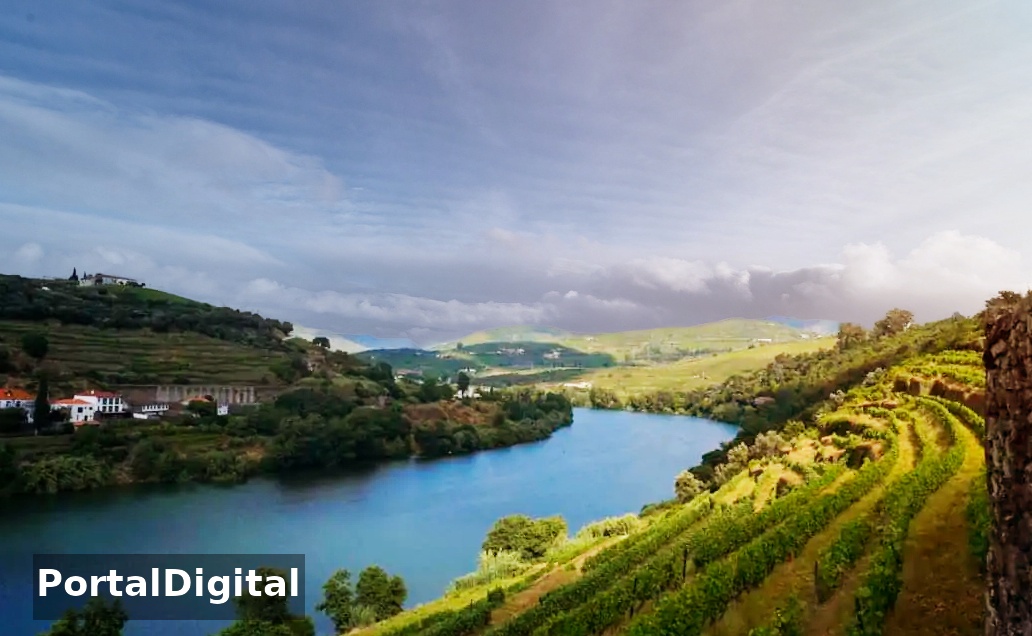
The Portuguese-Spanish River Minho that serves as the border between the north of Portugal and Galicia, from Melgaço to its mouth, in the Atlantic Ocean, in front of Caminha and La Guardia.
The Minho River originates in Spain, in the Cantabrian Mountains, in the Serra da Meira, at an altitude of 750 meters, and its course extends over approximately 340 kilometers, of which 230 are covered in Spain.
The total area of the Minho river basin is 22,500 km2, of which 800 km2 (around 5%) are located in Portuguese territory and 1934 km2 correspond to the international sub-basin.
In 2008, Valença City Council opened the Monte do Faro pedestrian trail, the brochure of which is available at the tourist office.
The Confraria do Monte do Faro in Valença organizes 2-wheeled “BTT Monte do Faro” competitions and a pedestrian route with a distance of 35 to 40 kilometers.
The large picnic area with stone tables and chairs spread across the Monte de Faro garden near the inn with the same name.
The garden consists of small lakes, dense trees that extend over a large area such as alder, willow, oak, chestnut, pine and gorse.
The Nossa Senhora do Faro Park is located at an altitude of 450 meters and has a large space made up of an immense forest of vegetation and centuries-old trees such as pine trees. It is considered one of the most privileged viewpoints in Alto Minho because it presents a magnificent and stunning view of the region and surroundings.
The elevation of Monte do Faro is clearly visible to the east of Valença, about six kilometers away, crowned by antennas and the view is fabulous, overlooking Valença, Tuy and a wide stretch of the River Minho.
At the top of Monte do Faro we find a chapel, a pillory and the visitor can observe a view that encompasses the entire Minho Valley (Portugal and Galicia) the busy commercial city of Valença with the bridge that connects Tui to the mouth of the river in Caminha.
A little further down are the chapels of Santa Ana and Santo Ovídio, which have as a backdrop a natural park with large leisure and picnic spaces painted green and highlighting the presence of eucalyptus, mimosas and australias.
From Monte do Faro, visitors can see the entire region of Valença and Tui, the River Minho, a natural park with leisure spaces and picnic areas.
The Portuguese-Spanish River Minho that serves as the border between the north of Portugal and Galicia, from Melgaço to its mouth, in the Atlantic Ocean, in front of Caminha and La Guardia.
The Minho River originates in Spain, in the Cantabrian Mountains, in the Serra da Meira, at an altitude of 750 meters, and its course extends over approximately 340 kilometers, of which 230 are covered in Spain.
The total area of the Minho river basin is 22,500 km2, of which 800 km2 (around 5%) are located in Portuguese territory and 1934 km2 correspond to the international sub-basin.
In 2008, Valença City Council opened the Monte do Faro pedestrian trail, the brochure of which is available at the tourist office.
The Confraria do Monte do Faro in Valença organizes 2-wheeled “BTT Monte do Faro” competitions and a pedestrian route with a distance of 35 to 40 kilometers.
The large picnic area with stone tables and chairs spread across the Monte de Faro garden near the inn with the same name.
The garden consists of small lakes, dense trees that extend over a large area such as alder, willow, oak, chestnut, pine and gorse.