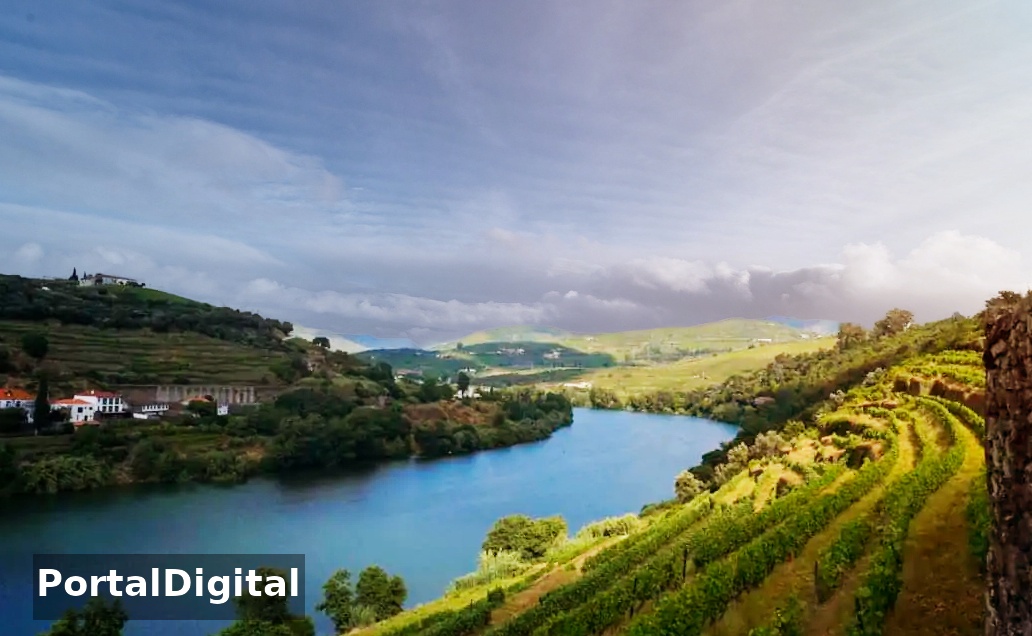
It is located in the Douro hydrographic basin, on the Douro River, between the banks of the municipalities of Lamego and Peso da Régua, district of Vila Real, Northern Region, of the Douro sub-region
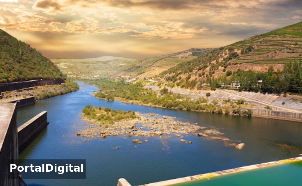
The Bagaúste Dam (also known as Barragem da Régua) is located on the Douro River between the municipalities of Lamego and Peso da Régua, 4 km from the city of Régua and was opened in 1973 and allows river navigation through the hydroelectric plant that generates electrical energy.
The Bagaúste Lock of Barragem da Régua is located 4km from the city of Régua, at km 105 of the Douro waterway (distance to the mouth) and next to the EN-222 road that connects Régua and Pinhão.
The Bagaúste Lock of Barragem da Régua is located 4km from the city of Régua, at km 105 of the Douro waterway (distance to the mouth) and next to the EN-222 road that connects Régua and Pinhão.
History of the Régua Dam
A plaque upriver in the Valeira cachão tells about the sinking of Senhora Ferreirinha - D. Antónia Adelaide Ferreira witnessed the death of her friend Baron de Forrester.
Her true vocation as a businesswoman prevented her daughter from having a forced marriage, becoming the largest exporter of Port wine by purchasing several farms and becoming a millionaire without losing the kindness with which she treated the families of the workers on her lands and cellars.
Her true vocation as a businesswoman prevented her daughter from having a forced marriage, becoming the largest exporter of Port wine by purchasing several farms and becoming a millionaire without losing the kindness with which she treated the families of the workers on her lands and cellars.
Characteristics of the Régua Dam
The Bagaúste Dam is a civil engineering work that requires a small stop to allow boats to pass through this water level.
The Régua Dam has a height of 41 m above the foundation and a length of 350 m, a difference in level of around 27m and cruises sailing on the Douro River between the city of Porto, Vila de Pinhão and also those going to Barca de Alva pass through its lock and the process of passing through the lock takes up to 30 minutes.
The dam includes on the left bank of the Douro, a lock for navigation, approximately 90 meters long by just over 12 meters wide, overcoming a difference in level of just over 28 meters with a total length of 350 meters and 41 meters high, it is a hydroelectric plant capable of producing 738 GWh on average per year.
The dam works to level the river so that it is navigable and the difference in level is around 28m (when the water level is at its maximum) incorporated into the dam there is a lock where boats enter and go up or down to the desired level and can continue on the journey and it takes around 20 minutes.
The dam has a drop in level of around 27m, and cruise ships sailing between the city of Régua and the town of Pinhão pass through its lock.
The dam is next to the EN222, a road that connects Régua and Pinhão, next to which there is a parking lot where visitors can park and watch the cruise ships passing through the lock, a process that takes up to 30 minutes and often brings together many people to watch the boats pass by.
The hydroelectric plant consists of three Kaplan groups with a total installed power of 156 (180) MW and the energy produced on average per year is 738 (581.1) GWh.
The dam on the left side is a lock for the Douro navigation channel with a length of around 90 m and a width of 12.1 m that overcomes a maximum difference in level of 28.5 m.
The Régua Dam is on the side of the highway and is undoubtedly a mandatory stop with a beautiful view of the large dam.
The Régua Dam, also called Bagaúste Dam, opened in 1973, is on the Douro River, between the banks of Peso da Régua and the municipality of Lamego.
Its use is for the production of electrical energy and for navigation, with a lock on the left side heading down the river with a length of 90 meters and a width of 12 meters over a difference in level of 28.5 meters.