
It is located on the left bank of the river Sado, on the northwest side of the Tróia peninsula, in front of Setúbal, in the municipality of Grândola, parish of Carvalhal, District of Setúbal, Central Portugal
In this place there was a population dedicated to fishing and the manufacture and export of preserved fish (garum) active from the 1st century to the 6th century. It is likely that the peninsula where the settlement was located was at that time an island that some identify as the island of Ácala referred to in the work Ora Maritima by Avieno, a Latin writer from the 4th century, but there is no archaeological data that proves that it was part of the territory of the city of Salacia (currently Alcácer do Sal).
In the 16th century, the humanists Gaspar Barreiros and André de Resende referred to the ruins, but seem to have confused them with Cetóbriga (Setúbal). Several authors mentioned them in the following centuries, and in the second half of the 18th century the first known archaeological excavations were carried out, sponsored by the Infanta (and future queen) Dona Maria I, in these works some Roman houses were excavated in the area today called "Rua das Casas da Princesa" in honor of the Infanta.
In 1850, excavations gained new impetus with the creation of the Lusitanian Archaeological Society, which carried out work in the "Casas da Princesa" where they found walls with paintings and floors with mosaics that had since disappeared. Recently, several campaigns were carried out in which baths, salt houses, necropolises and the paleochristian basilica (1948-1967) were excavated.
The most characteristic structures of Tróia are the many fish salting workshops, the ruins also include a housing nucleus with houses on the ground floor, first floor (the so-called "Princess Houses"), several necropolises, a columbarium, thermal baths, a water wheel (rota aquaria) and the remains of a paleo-Christian basilica.
Troy's industrial activity was centered on fishing and the manufacture of preserved fish that was exported to the rest of the Roman Empire and was active between the 1st and 6th centuries AD.
The location on an island, the abundant fishing, the excellence of the region's salt and the amphorae used as packaging came from potteries located on the right bank of the Sado river, like Abul, an ancient Phoenician trading post.
The salting workshops were made up of a series of tanks (cetarias) organized around a central courtyard, a total of twenty workshops were identified, with varying dimensions: the largest was more than 1000 m2 and had 19 tanks, while the smallest had 135 m2 and 9 tanks, and it is believed that a considerable amount of fish was produced for export, although the volumes are unknown today.
The remains of the baths, excavated in 195, occupy an area of 450 m2 and included an apoditerium (vestibule), frigidarium (cold water tank), tepidarium (warm water), caldarium (hot water) with an underground heating system (hypocaust), various pools and a gym, in one of the pools there are remains of mosaics.
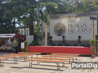
The Classification of the Roman Ruins of Troy
The ruins encompass several buildings from the period between the 1st and 6th centuries and have been classified as a National Monument since 1910.