It is located on Rua da Lagoa, parish of S. Pedro d'' Arcos, Vila de Ponte de Lima, district of Viana do Castelo, North region and sub-region of Minho-Lima
The Water Route is a pedestrian route called a small route and the respective markings and signage comply with international standards.
The route takes place in the Protected Area of Lagoas de Bertiandos and S. Pedro d’Arcos, allowing an understanding of the origin and movement of water in space.
We begin the journey at the Environmental Interpretation Center to Quinta de Pentieiros, which is part of the Protected Area project associated with accommodation, recreation and leisure and an educational farm.
In the length covered, urban spaces associated with complex parcel agricultural systems predominate and returning to the route we head towards Estorãos.
The visitor comes across the Arga and Cabração mountains, which are the upper limits of the Estorãos river basin.
The basin with around 5440 ha has the Estorãos River as its main watercourse and its characteristics associated with climatic conditions justify the formation of a valley area subject to periodic flooding where the Protected Area is located.
Next to the Estorãos Church we turn right towards the bridge and the Estorãos water mill and leave the riverside landscape crossing the bridge towards the Lousa veiga.
In this agricultural area there is signage alluding to the Estorãos irrigation scheme whose water comes from abstraction carried out upstream on the river.
At the Statue of the Four Hands, which is a symbol of the union of four parishes faced with serious subsistence problems, we turn right heading towards the Antiga Cooperativa de Estorãos.
On the left side it is accompanied by the irrigation canal that transports water for irrigation in the Sobreiro veiga and the S. Pedro d’Arcos lagoon, ensuring the maintenance of this biotope in the summer.
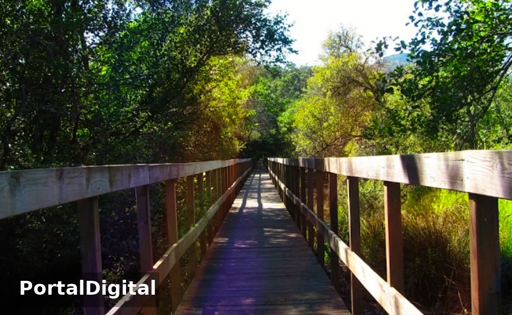
After passing over the Estorãos river, we turn left along a trail that takes us to the Mimoso lagoon and pass over a wooden bridge where in winter the water from the river enters the Fujacos stream, leading to the formation of a temporary lake in the Protected Area.
The lagoon, functioning as a refuge, feeding and reproduction area, consists of a seasonal body of water surrounded by hygrophilous forests that are home to species with high conservation value.
The lakes in the Protected Area, located in natural depressions in the land, are supplied by rainwater, the increase in the water table, the Leira Longa and Portela streams and the Estorãos irrigation system.
At the Mimoso lagoon, following the route we head towards Estrada Nacional (EN) 202, next to which is located the Solar de Bertiandos, one of the ex-libris of the north of the country.
The Lima River receives water drained by the Estorãos and the State ditch, the watercourse built to drain the S. Pedro d’Arcos lagoon, causing it to leave the basin.
At the end of the straight, we turn right and follow the signs to the Environmental Interpretation Center, passing through Quinta da Lage, founded in the 17th century. XV.
The route takes place in the Protected Area of Lagoas de Bertiandos and S. Pedro d’Arcos, allowing an understanding of the origin and movement of water in space.
We begin the journey at the Environmental Interpretation Center to Quinta de Pentieiros, which is part of the Protected Area project associated with accommodation, recreation and leisure and an educational farm.
In the length covered, urban spaces associated with complex parcel agricultural systems predominate and returning to the route we head towards Estorãos.
The visitor comes across the Arga and Cabração mountains, which are the upper limits of the Estorãos river basin.
The basin with around 5440 ha has the Estorãos River as its main watercourse and its characteristics associated with climatic conditions justify the formation of a valley area subject to periodic flooding where the Protected Area is located.
Next to the Estorãos Church we turn right towards the bridge and the Estorãos water mill and leave the riverside landscape crossing the bridge towards the Lousa veiga.
In this agricultural area there is signage alluding to the Estorãos irrigation scheme whose water comes from abstraction carried out upstream on the river.
At the Statue of the Four Hands, which is a symbol of the union of four parishes faced with serious subsistence problems, we turn right heading towards the Antiga Cooperativa de Estorãos.
On the left side it is accompanied by the irrigation canal that transports water for irrigation in the Sobreiro veiga and the S. Pedro d’Arcos lagoon, ensuring the maintenance of this biotope in the summer.
After passing over the Estorãos river, we turn left along a trail that takes us to the Mimoso lagoon and pass over a wooden bridge where in winter the water from the river enters the Fujacos stream, leading to the formation of a temporary lake in the Protected Area.
The lagoon, functioning as a refuge, feeding and reproduction area, consists of a seasonal body of water surrounded by hygrophilous forests that are home to species with high conservation value.
The lakes in the Protected Area, located in natural depressions in the land, are supplied by rainwater, the increase in the water table, the Leira Longa and Portela streams and the Estorãos irrigation system.
At the Mimoso lagoon, following the route we head towards Estrada Nacional (EN) 202, next to which is located the Solar de Bertiandos, one of the ex-libris of the north of the country.
The Lima River receives water drained by the Estorãos and the State ditch, the watercourse built to drain the S. Pedro d’Arcos lagoon, causing it to leave the basin.
At the end of the straight, we turn right and follow the signs to the Environmental Interpretation Center, passing through Quinta da Lage, founded in the 17th century. XV.